services
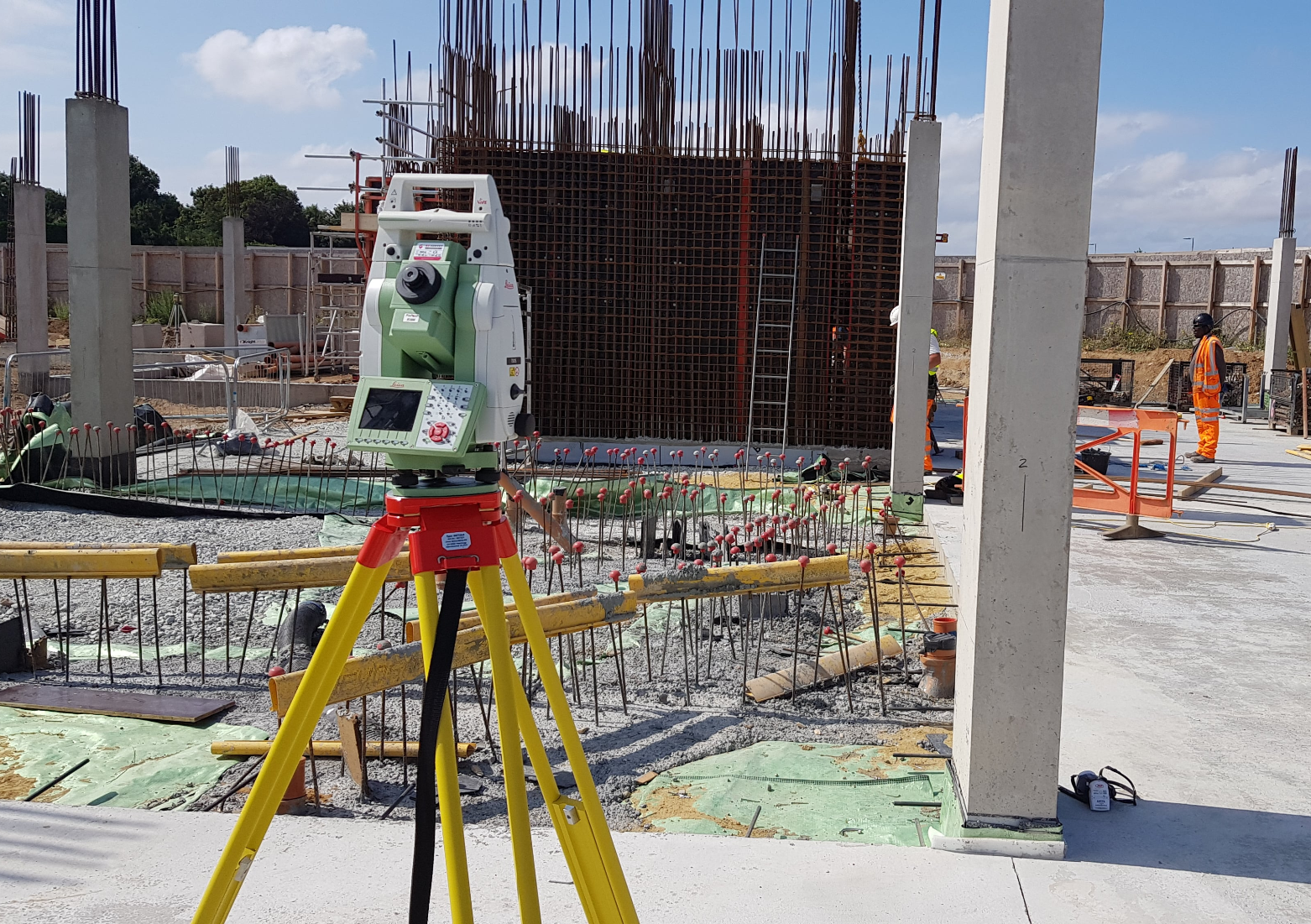
All on-site work is undertaken using Leica Total Station & GPS equipment, with drawings produced using AutoCAD LT. All industry-leading equipment and software recognised for its speed, accuracy and reliability. Professional Land Surveyor Essex based projects, as well as other areas, are all completed using this equipment.
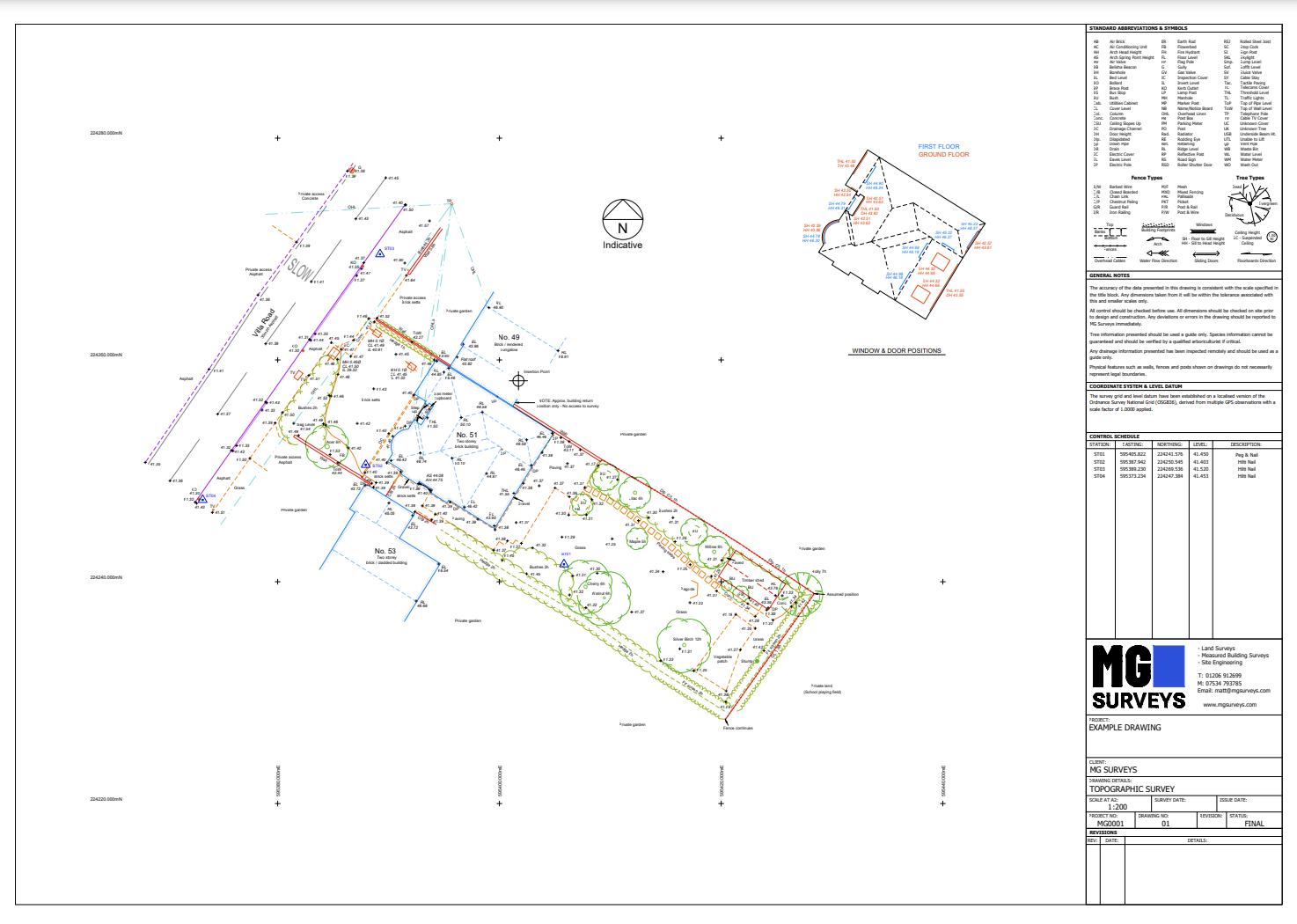
LAND / TOPOGRAPHIC SURVEYS
All drawings are related to the Ordnance Survey OSGB36 National Grid via GPS observations and come with a 3D layer as standard. Required levels of detail for things such as road markings, drainage, rooflines, surrounding off-site building positions and ridge/eave levels can be specified during quotation.
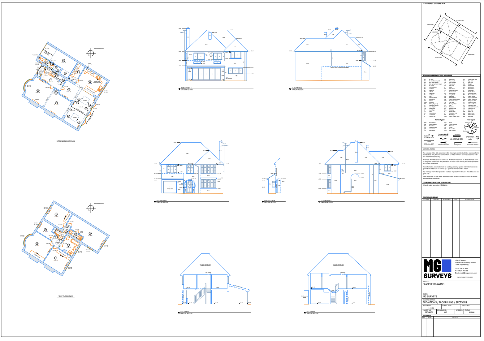
measured building surveys
Floorplans, elevations, roof plans and sections of any type of buildings or structure can be provided. As with Land/Topographic Surveys the level of detail required can be specified, with just basic information recorded if you are looking for a quicker turnaround on your project.
site engineering
I hold a CSCS card and can work on all aspects of Site Engineering including setting out of foundations, brickwork, roads, drainage, gridlines and datums, as well as conducting as-built surveys, establishing control networks, monitoring exercises, volume calculations and verticality checks.
Professional Land Surveyor Essex
Please note that the above list is not exhaustive. I have excellent problem-solving skills and can work hard to find a solution to any problem that would benefit from the application of a high accuracy measuring system. For an expert Land Surveyor Essex, or the highest quality Measured Building Surveys or Site Engineering contact Matt for a very competitive quote.
areas I cover
I cover the majority of the East Anglia region, generally from Cambridge and Norwich to the North and following the coast down the outskirts of London to the South.